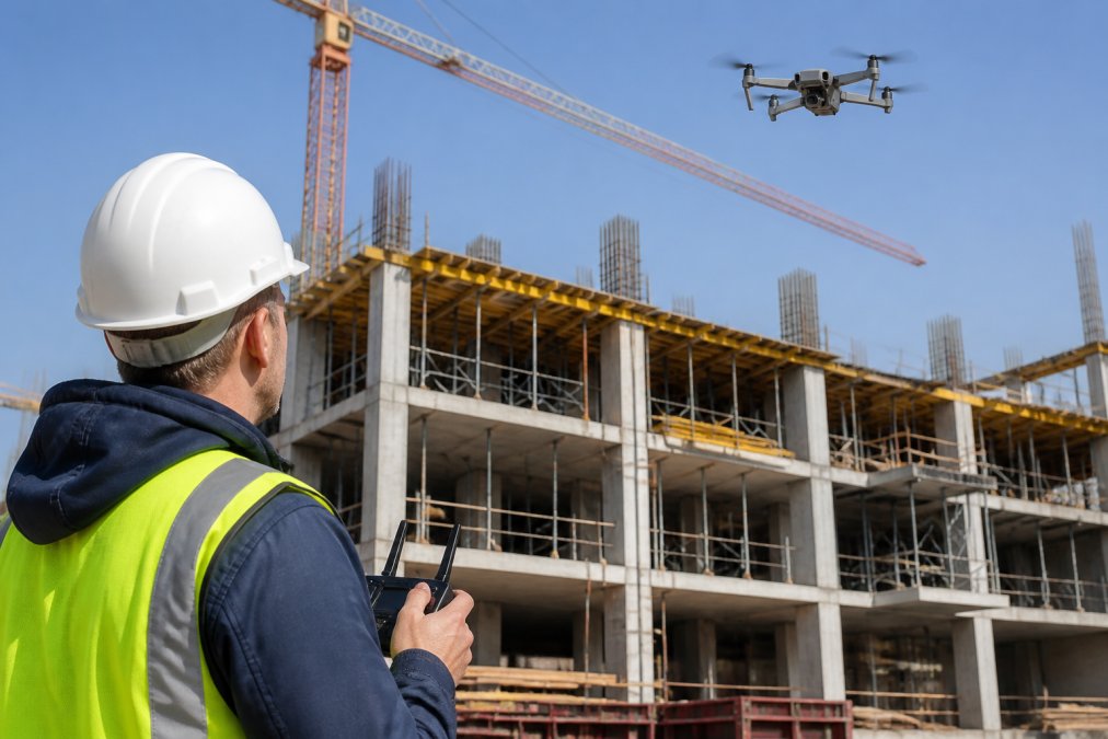
Drone Inspection for Construction: A Complete Guide
Table of Contents
- What Drone Inspection for Construction Site Progress Actually Does
- Key Benefits: Safety, Speed, and Data-Driven Decisions
- FAA Part 107 Requirements for Construction Drone Operations
- Building Your Aerial Monitoring Workflow: From Flight to Report
- Construction Drone Mapping Software and Data Integration
- Creating a Drone Construction Progress Report Template
- Real-World Challenges: Weather, Storage, and Site Logistics
- Conclusion
Last Updated: August 14, 2026
What Drone Inspection for Construction Site Progress Actually Does
Drone inspection for construction captures high-resolution imagery and geospatial data that reveal jobsite conditions in minutes rather than days. Unlike ground-based surveys, this technology transforms how teams document milestones, identify safety risks, and communicate project status to stakeholders.
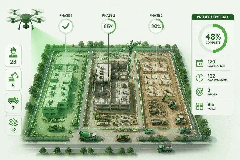
Drone inspection delivers three critical advantages: it compresses documentation timelines, eliminates blind spots in site visibility, and creates defensible records for liability protection. A single flight captures what would take a ground crew hours to document manually, producing GPS-tagged photos, orthomosaic maps, and point cloud data that serve as as-built comparisons later.
The workflow requires precision: plan the flight path, execute the capture mission under FAA compliance, process raw imagery into actionable datasets, and deliver reports stakeholders can use. Most teams underestimate post-processing. Raw drone footage becomes useful only when stitched into orthomosaics, analyzed for volumetric changes, or integrated with your BIM model. That's where data becomes decision-making intelligence.
Drone inspection also solves persistent site logistics visibility problems. Project managers can't be everywhere simultaneously. Drones provide real-time visibility into equipment placement, material staging, personnel movement, and progress against schedule, feeding into risk mitigation strategies before small issues become expensive delays or safety incidents.
Key Benefits: Safety, Speed, and Data-Driven Decisions
The operational case for drone inspection construction rests on three compounding pillars.
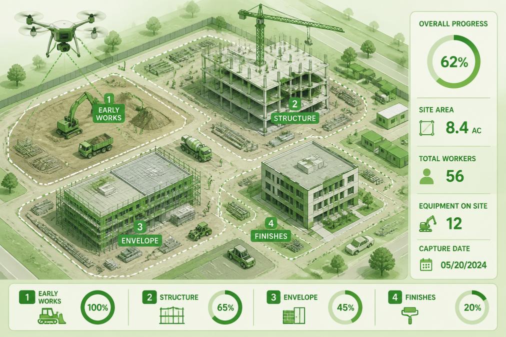
Safety improvements come first. Traditional monitoring requires personnel to climb scaffolding, navigate hazardous zones, or position themselves dangerously to photograph work areas. Drones eliminate this exposure. You capture thermal imagery of electrical systems, inspect high-reach installations without sending workers aloft, and document hazardous conditions from a safe distance. Insurance carriers recognize this risk reduction and often offer premium reductions when drone documentation replaces manual inspections.
Speed is the second advantage. A drone flight takes 15-30 minutes with processing requiring 2-4 hours depending on site size. Compare that to a ground crew spending a full day documenting the same area manually. Weekly or bi-weekly progress checks across multiple projects accumulate rapid time savings. This speed also means you catch scheduling slippage faster, enabling course corrections before problems compound.
Data-driven decision making is where drone inspection proves its ROI. You have objective geospatial records instead of subjective observations. Orthomosaic generation creates georeferenced maps showing exact equipment positions and material stockpiles. Volumetric analysis tracks excavation progress with precision that beats manual surveys. Point cloud data integrates directly into BIM workflows, enabling as-built comparisons that reveal deviations from design intent. When disputes arise about progress, timeline compliance, or damage responsibility, drone documentation provides evidence that photographs cannot.
FAA Part 107 Requirements for Construction Drone Operations
You cannot legally operate a drone on a construction site without understanding FAA Part 107 regulations. Violations carry fines up to $27,500 and potential criminal liability.
The core requirement: Any person operating a drone for commercial purposes must hold a Remote Pilot Certificate under FAA Part 107, obtained by passing the aeronautical knowledge test covering airspace rules, weather interpretation, aircraft performance, and emergency procedures. The certification is valid for two years.
Operational constraints that matter for construction sites:
You must maintain visual line of sight (VLOS) with the aircraft at all times. You cannot fly above 400 feet AGL (above ground level) unless within 400 feet of a structure, which is common on construction sites but requires specific planning and documentation.
You cannot fly over people or populated areas. Construction sites have personnel moving around, so flight plans must account for this. Many operators establish restricted zones where drones don't operate or schedule flights during hours when non-essential personnel are absent.
Airspace authorization may be required. If your site is near an airport or within controlled airspace, you need FAA approval before flying through LAANC (Low Altitude Authorization and Notification Capability), which is free and typically processes in minutes.
Weather minimums are strict. You cannot fly in rain, snow, or fog, or in winds exceeding 25 mph. These are regulatory minimums, not suggestions.
Documentation requirements: Maintain records of every flight including date, time, location, pilot name, aircraft serial number, and any incidents. Construction sites should have a drone operations SOP specifying who can authorize flights, how airspace is checked, and procedures if weather deteriorates mid-flight.
Insurance implications: Most general liability policies exclude drone operations. You need specific drone insurance covering commercial operations, typically costing $300-600 annually. When you contract with Clear Focus Imaging for drone inspection for construction, our Part 107 certification and commercial insurance are in place, eliminating the regulatory and liability burden.
Building Your Aerial Monitoring Workflow: From Flight to Report
A functional drone inspection workflow has five distinct phases, each with potential failure points.
Pre-Flight Planning and Site Assessment
Before the drone launches, you need a documented flight plan addressing airspace, weather, personnel safety, and data objectives.
Start with airspace research using the FAA's B4UFLY app or LAANC to check if your site is in controlled airspace. Request authorization 24 hours in advance if needed. Conduct a site survey identifying obstacles, power lines, cranes, and personnel staging areas. Mark no-fly zones and identify your launch point, a flat, clear area away from personnel. Brief the site supervisor and safety manager about the planned flight.
Check weather conditions. Wind speed matters most; gusts above 25 mph are unsafe. Overcast conditions are actually ideal for orthomosaic work because they eliminate harsh shadows. Define your flight objectives, are you documenting overall progress, inspecting a specific area, or measuring excavation depth? Your objectives determine flight altitude, camera settings, and overlap requirements. Orthomosaic generation requires 80% forward overlap and 70% side overlap between images.
Data Capture and Processing
The actual flight takes 20-30 minutes, capturing 200-500 images depending on site size and altitude. Raw data is not useful until processed into three deliverables: orthomosaics, point clouds, and 3D models.
Orthomosaics are georeferenced aerial maps where every pixel has a known geographic location. They're created by stitching overlapping images and correcting for perspective distortion, resulting in a map-view of your site with real-world coordinates for measuring distances and tracking changes.
Point clouds are 3D datasets where each image pixel becomes a point in space. Photogrammetry software analyzes image overlap and calculates depth, creating a dense 3D representation that integrates directly into BIM software for as-built comparisons and volumetric analysis.
CALL Clear Focus Imaging TODAY →
Processing typically requires 2-4 hours depending on site size and software. Professional tools like Pix4D, DroneDeploy, or WebODM automate alignment, tie-point detection, and mesh generation. A single flight generates 5-15 GB of raw imagery, requiring strong cloud storage with version control. Raw images are typically archived for 90 days then deleted after processing, while processed datasets are kept indefinitely.
Construction Drone Mapping Software and Data Integration
Construction drone mapping software bridges raw imagery and actionable intelligence. Pix4D is the industry standard for photogrammetry, excelling at processing large datasets with high accuracy and integrating with major CAD and BIM platforms. DroneDeploy targets construction specifically with cloud-based processing and integration with Autodesk BIM 360. WebODM is open-source and free, surprisingly capable for small-to-medium sites with local processing.
BIM integration is transformative. Importing point clouds into your design model enables measurement of deviations, identification of clashes, and tracking of as-built conditions. This requires proper coordinate systems, your drone data must be georeferenced to the same coordinate system as your design model.
Thermal inspection is becoming standard, detecting temperature variations that reveal electrical issues, insulation problems, and equipment malfunctions. The choice of software depends on your workflow: use DroneDeploy if you're using Revit and BIM 360, Pix4D for maximum processing power, or WebODM for cost minimization on small sites.
Creating a Drone Construction Progress Report Template
A drone construction progress report communicates progress clearly, shows evidence, and enables decisions. Your template should include:
Executive Summary: One page maximum with project name, reporting period, overall progress percentage, and key findings with a single orthomosaic image.
Progress Metrics: Show quantified progress backed by point cloud data. "Foundation 45% complete based on volumetric analysis" is stronger than subjective estimates.
Photographic Evidence: Include 8-12 georeferenced aerial images showing key areas using orthomosaic extracts rather than raw photos, annotated with measurements.
Safety and Risk Observations: Flag safety issues visible from aerial perspective, equipment in unsafe positions, personnel in hazardous areas, or material storage blocking egress routes.
Schedule Compliance: Compare actual progress to planned progress with specificity. "Concrete pour on Building A is 5 days behind schedule based on foundation excavation progress" is actionable.
BIM Comparison: Include as-built point cloud comparisons to design showing areas where the site deviates from the model.
Recommendations: Close with specific recommendations for corrective actions or efficiency improvements.
A well-structured report takes 2-3 hours to produce after data processing, driving faster decisions and reducing stakeholder uncertainty.
Real-World Challenges: Weather, Storage, and Site Logistics
Three challenges consistently disrupt workflows: weather limitations, data storage logistics, and site access complications.
Weather is your primary constraint. Wind above 25 mph becomes unstable; many operators maintain a 20 mph buffer. Rain is an absolute blocker. Cold weather affects battery performance, a battery flying 25 minutes in 70-degree weather might only fly 15 minutes in 40-degree weather. Schedule flights with backup dates rather than committing to specific delivery dates.
Data storage grows quietly. A single flight generates 5-15 GB of raw imagery. Weekly flights on a 20-project portfolio generate 5+ TB monthly. Cloud storage charges for storage and bandwidth. Keep raw images for 90 days then delete after processing; retain processed datasets indefinitely as they're smaller and have long-term reference value.
Site logistics complicate access. Construction sites are dynamic, equipment moves and personnel density changes. Coordinate with the site superintendent before every flight. Many teams schedule flights early morning before the full crew arrives or late afternoon after personnel leave.
Drone inspection for construction has moved from novelty to necessity. The combination of safety improvements, time savings, and objective documentation creates a compelling business case. Success depends on execution discipline: FAA certification, appropriate insurance, strong software workflows, and realistic expectations about weather and logistics. Many teams that attempt DIY drone operations fail because they underestimate post-processing complexity and data management requirements. Partnering with Clear Focus Imaging eliminates these operational headaches. Our team handles FAA compliance, data processing, BIM integration, and report delivery, so you get actionable intelligence without managing technical infrastructure. Contact us for a consultation to discuss how drone inspection for construction can improve your project documentation and decision-making.
Frequently Asked Questions
Are you allowed to fly a drone over a construction site?
Yes, but only with proper authorization. You must obtain a Part 107 certificate from the FAA, secure written permission from the property owner or site manager, and comply with airspace restrictions. Construction sites near airports or in controlled airspace require additional approvals. Always verify local regulations before flight operations.
Do I need a Part 107 license to conduct drone inspection for construction site progress monitoring?
Yes. Anyone flying a drone commercially, including for construction progress documentation, must hold an FAA Part 107 Remote Pilot Certificate. This requires passing a written exam and maintaining current knowledge of airspace regulations, safety protocols, and operational limitations. Hiring a certified operator ensures compliance and protects your project.
What should a drone construction progress report template include?
An effective template should include: date and weather conditions, GPS-tagged photos or orthomosaic imagery, project milestone comparisons, volumetric measurements where applicable, identified safety hazards or delays, equipment and personnel counts, and next-phase recommendations. Organize data chronologically and link visual evidence to specific project sections for easy stakeholder review and decision-making.
How much does drone inspection for construction actually cost compared to traditional site documentation?
Costs depend on project size, flight frequency, data processing complexity, and software integration. Drone inspection typically reduces labor hours for manual documentation and speeds project timelines, offsetting initial investment. Many projects see ROI through faster problem identification and reduced rework. Contact a certified operator for a quote based on your specific site needs.
What construction drone mapping software integrates with BIM and CAD workflows?
Leading platforms capture high-resolution imagery, orthomosaics, and point cloud data that integrate directly into BIM models and CAD software. The best tools automate geospatial data processing, enable as-built comparisons against design plans, and generate volumetric analysis for material tracking. Proper software integration eliminates manual data entry and improves accuracy across your project lifecycle.
How does drone inspection improve construction project timelines?
Aerial monitoring provides real-time visibility into project progress, identifies delays or safety issues before they escalate, and enables faster decision-making by stakeholders. Automated progress tracking through orthomosaic generation and as-built comparisons eliminates time-consuming manual surveys. Early risk detection and data-driven decisions reduce rework and keep projects on schedule.
This article was written using GrandRanker
