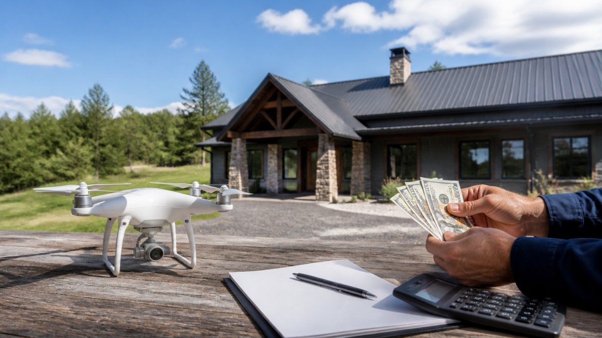
Save Money on Aerial Visuals: A How-To for Real Estate
Table of Contents
- Why Aerial Visuals Matter for Your Bottom Line
- Understanding Drone Photography Pricing for Real Estate
- Best Practices for Real Estate Drone Shots
- Real Estate Marketing Strategies for Agents Using Aerial Content
- DIY vs. Professional Drone Photography: A Cost-Benefit Analysis
- Compliance and Safety: What You Need to Know
- Getting Started: Your Action Plan
- Frequently Asked Questions
Last Updated: October 3, 2026
Why Aerial Visuals Matter for Your Bottom Line
Aerial drone photography showcases properties from a unique perspective that ground-level photos cannot capture, translating directly to faster sales, higher asking prices, and more serious buyer inquiries.
Properties with professional aerial imagery attract more attention online, generate more qualified leads, and close faster, often within weeks instead of months.
At Clear Focus Imaging, we help real estate professionals understand that saving money with aerial visuals doesn't mean compromising on quality. It means being strategic about when and how you invest in drone photography to maximize ROI on every listing.
Understanding Drone Photography Pricing for Real Estate
Drone photography costs vary based on deliverables: a simple aerial overview costs far less than a full cinematic video tour with multiple angles, editing, and color grading.
What Affects Your Cost
Property size, complexity, and editing requirements drive costs. A sprawling estate requires more flight time than a compact lot; raw footage costs less than professionally edited content with music, transitions, and color correction.
Location accessibility, airspace restrictions, and terrain complexity also affect pricing.
A single aerial photograph costs less than a cinematic video tour. Real estate marketing strategies for agents using aerial content often combine multiple formats, still images, video clips, and full tours, which increases the overall budget.
Pricing Models: Per-Project vs. Retainer for Developers
Real estate agents and developers managing multiple properties benefit from different pricing structures.
A retainer or package model works better for developers. Monthly or quarterly retainers can reduce per-shoot costs compared to one-off pricing and ensure faster turnaround times and priority scheduling.
For land development, aerial documentation serves dual purposes: marketing and progress tracking. A 50-lot subdivision benefits from baseline imagery and monthly or quarterly follow-up shots showing construction progress, supporting investor communications, financing updates, and marketing. A professional operator can bundle recurring shoots into a package costing less than individual rates while providing continuous visual documentation.
ROI Calculation for Residential Sales
Properties with professional aerial imagery can spend less time on the market, reducing carrying costs and opportunity cost.
ROI for Land Development and Progress Tracking
Developers face different ROI calculations. This investment delivers:
- Investor confidence: Monthly or quarterly aerial updates showing tangible progress reduce investor anxiety and support capital calls. Investors seeing visible progress are more likely to fund subsequent phases.
- Marketing acceleration: Finished lots photographed from the air with surrounding completed homes sell faster. Aerial imagery showing the community context and amenities drives buyer interest earlier in the development cycle.
- Dispute prevention: Documented aerial baseline and progress shots protect against boundary disputes, environmental claims, or contractor disputes. Visual evidence of site conditions at each phase is valuable if issues arise.
- Lender requirements: Many construction lenders require periodic aerial documentation as part of loan covenants. Professional imagery satisfies these requirements and supports draw requests.
Regular visual updates can also reduce capital call delays.
Getting an Accurate Quote
Request a consultation with a professional drone service. Provide details about your property, goals, timeline, and whether you need still photography, video, both, or specialized services like property overlays and boundary lines.
For developers, specify whether this is one-time or recurring documentation, how many properties or phases, and timeline. Recurring work justifies volume discounts.
When comparing quotes, ask what's included: editing, number of photos, video length, revisions, and additional angles. This prevents surprises and enables fair comparison. If you're managing multiple facilities or properties, ask whether the provider offers Real Estate Media services that can integrate aerial visuals with other marketing content for a cohesive strategy.
Federal Aviation Administration's Part 107 regulations require that commercial drone operators hold proper certification. Any legitimate service provider should be able to verify their credentials. This certification ensures they understand airspace rules, safety protocols, and legal requirements, factors that justify professional pricing and protect your investment.
Best Practices for Real Estate Drone Shots
Capturing compelling aerial visuals requires more than just flying a drone over a property. Strategic timing, proper camera angles, and an understanding of what buyers want to see separate mediocre footage from marketing assets that actually drive results.
Timing and Weather Conditions
Golden hour, shortly after sunrise or before sunset, produces the most visually appealing real estate photography. Warm, directional light flatters properties and creates depth; afternoon shadows obscure features, and overcast days flatten images.
Clear skies photograph best; wind affects stability and safety, while rain or fog compromises quality. Professional operators plan shoots around optimal weather windows, so scheduling flexibility avoids premium rush fees.
Spring and early summer show lush landscaping; winter reveals structure but may look less inviting. Choose the season that best showcases your property.
Essential Camera Angles and Perspectives
Start with a wide establishing shot showing the property in context with surroundings and neighborhood. Follow with closer angles highlighting key features: architectural details, pool, driveway, mature trees, or proximity to amenities.
Aerial twilight shots, taken after sunset when the sky holds color and interior lights are on, create stunning marketing images that stand out in listing feeds, though they require specific timing and technical skill.
Property overlays and boundary lines help buyers understand lot size, especially valuable for land development or larger estates. These require post-processing expertise but provide concrete information that influences buyer confidence.
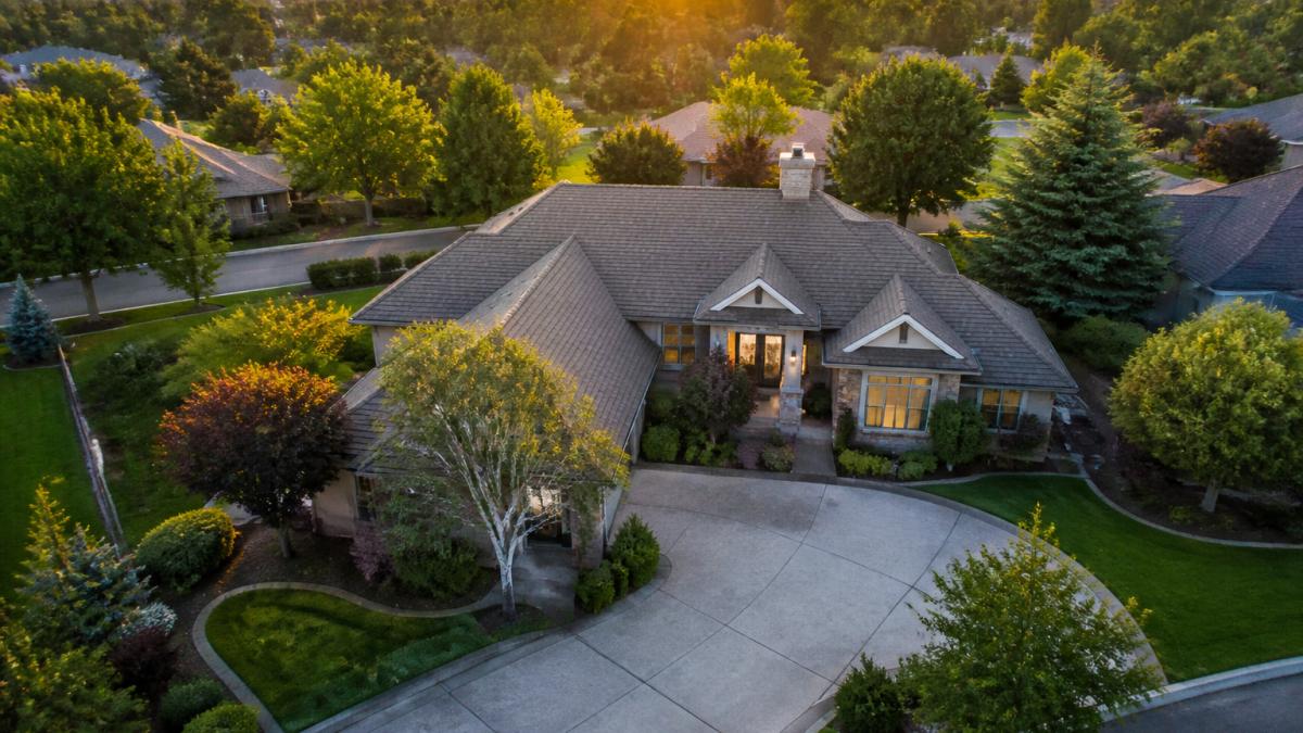
Vary perspective: high altitude shots showing property and neighborhood, medium-range angles highlighting relationships to surrounding features, and lower passes emphasizing architectural details. This creates a complete visual story.
Real Estate Marketing Strategies for Agents Using Aerial Content
Aerial visuals are only valuable when integrated strategically into your overall marketing approach and deployed across the right channels at the right time.
Integrating Aerial Footage Into Your Listings
Use your best aerial image as the hero photo on all major platforms. This immediately differentiates your listing from competitors using only ground-level shots.
CALL Clear Focus Imaging TODAY →
Incorporate 15-30 second aerial video clips into listing descriptions and social media. Listings with video generate significantly more engagement than static images alone. Professional Social Media Content strategies can amplify your aerial visuals across multiple platforms, ensuring maximum visibility and engagement.
3D virtual tours combining aerial footage with interior photography create comprehensive digital walkthroughs that reduce tire-kicking visits and attract more serious, informed buyers.
Measuring ROI on Your Investment
Track metrics: time on market, inquiry volume, buyer feedback, and showings. Compare listings with aerial photography to your baseline.
Compare selling prices with professional aerial marketing to your baseline.
DIY vs. Professional Drone Photography: A Cost-Benefit Analysis
The temptation to save money by handling drone photography yourself is understandable. However, the risks and limitations often outweigh the savings.
DIY drone photography requires purchasing equipment (drone, batteries, memory cards, insurance) costing hundreds to thousands upfront, plus learning drone operation, airspace regulations, and post-processing. A crashed drone or damaged property creates liability that negates savings.
Professional operators position shots for maximum impact, work within regulatory requirements, edit to professional standards, carry liability insurance, and deliver faster turnarounds and consistent quality.
For occasional shoots, professional services make financial sense. Most real estate professionals find that outsourcing frees up time for sales work while ensuring professional results.
Compliance and Safety: What You Need to Know
Commercial drone operations in the United States require Federal Aviation Administration Part 107 certification. Any service provider operating drones commercially must hold this credential.
Part 107 certification requires passing an exam covering airspace rules, weather, emergency procedures, and safety protocols. Certified operators understand weight restrictions, altitude limits, airspace classifications, and local regulations.
Local Airspace and Cherokee County Considerations
Property location affects legal permissions beyond Part 107 rules. The area sits within Class E airspace, allowing drone operations but requiring awareness of general aviation activity. Properties near regional airports may face additional restrictions.
Individual municipalities may impose local restrictions on drone operations, require advance notification to law enforcement, or have noise and privacy ordinances. A professional operator familiar with local requirements navigates these quickly; inexperienced pilots may face delays or fines.
Operators must respect neighboring properties and airspace. Tall structures, power lines, and tree cover create hazards requiring site-specific planning. Local knowledge prevents costly crashes and ensures efficient shoots.
Insurance and Liability Protection
Liability insurance is essential and often misunderstood. Professional drone services carry coverage that protects both the operator and property owner. This insurance covers damage to property, injury to people, or equipment loss. Operating without proper insurance creates significant legal and financial exposure.
Standard homeowner or business insurance policies do not cover drone operations. If a rented or owned drone damages a neighbor's property, vehicle, or person, the property owner can be held liable. Professional operators carry commercial general liability coverage specifically for aerial work, typically in the $1 million to $2 million range. This protects you if an accident occurs during a shoot on your property.
DIY operators often skip insurance to save money, creating a false economy. A single incident, a drone striking a power line, damaging a neighboring roof, or injuring a person, can result in tens of thousands of dollars in liability claims. Professional services include this protection as part of their cost structure.
Verification and Due Diligence
Before hiring any drone service, request proof of Part 107 certification and current liability insurance. The FAA maintains a searchable database of certified remote pilots; you can verify credentials independently. Insurance certificates should list your property or company as an additional insured, protecting you in case of claims.
Ask potential providers about their experience with local airspace and any special permits or waivers they've obtained for the area. Operators who have worked multiple properties locally understand the nuances and can complete shoots faster and more safely than those unfamiliar with regional conditions. This local expertise is a legitimate reason to choose a provider over a cheaper out-of-area alternative.
Getting Started: Your Action Plan
Begin by clarifying your specific needs. What properties do you need photographed? How frequently? What deliverables do you need, still images, video, both? What's your timeline and budget?
Research local drone service providers. Verify that they hold Part 107 certification and carry liability insurance. Review their portfolio to assess whether their style matches your marketing vision. Ask for references from other real estate professionals.
Request quotes from multiple providers. Provide consistent information to each so you can compare apples to apples. Ask what's included, what revisions are allowed, and how quickly you'll receive final deliverables.
Start with a single property or small project to evaluate the provider's work quality and responsiveness. If results meet expectations, scale up your investment.
Clear Focus Imaging specializes in real estate drone photography and understands the specific needs of agents and developers.
Professional aerial photography transforms how properties are marketed and perceived by potential buyers. The investment in high-quality visuals consistently delivers measurable returns through faster sales, higher prices, and more qualified leads.
Frequently Asked Questions
How much does professional aerial photography for real estate typically cost?
Professional drone photography pricing depends on the property size, location, editing complexity, and turnaround time. Rather than guessing at a range, contact a local provider like Clear Focus Imaging for a custom quote. Most professionals offer package pricing for single properties versus multi-property projects, so your actual investment varies based on your specific needs. Request a free consultation to understand pricing for your situation.
How does aerial photography impact how fast a property sells?
High-quality aerial visuals increase buyer engagement by showcasing property features that ground-level photos miss, such as lot size, land boundaries, surrounding landscape, and neighborhood context. Properties with professional aerial imagery often attract more serious inquiries and can reduce time on market. The visual storytelling advantage of drone footage helps buyers understand the property's true value faster than traditional photography alone.
Are drone pilots required to be FAA certified to fly over residential properties?
Yes. Commercial drone operations, including real estate photography, require the pilot to hold a Part 107 certification from the FAA. This certification ensures the operator understands airspace regulations, safety protocols, and local flight restrictions. Before hiring any aerial photography service, verify they employ Part 107 certified pilots to ensure legal compliance and professional standards.
What makes professional drone photography better than DIY or cheaper alternatives?
Professional operators bring equipment expertise, post-production editing skills, and regulatory knowledge that DIY solutions lack. They understand optimal camera angles, lighting conditions, and composition for real estate marketing. Professional pilots also carry liability insurance and maintain compliance with FAA regulations, protecting you from legal and safety risks. The investment in quality aerial content typically generates faster sales and stronger buyer interest, offsetting the service cost.
