How Drone Photography Increases Property Value
Table of Contents
- How Drone Photography Increases Property Value
- Benefits of Aerial Photography in Real Estate Marketing
- Real Estate Drone Photography Pricing and ROI Calculation
- FAA Part 107 Requirements for Real Estate Drone Operations
- Technical Considerations and Post-Production Standards
- Seasonal Strategies and Property-Type Applications
- Maximizing Social Media Engagement with Aerial Visuals
- Conclusion
Last Updated: August 15, 2026
How Drone Photography Increases Property Value
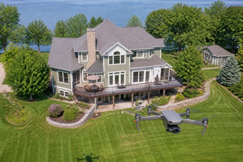
Aerial imagery has fundamentally changed property marketing and valuation. When potential buyers see a property from above, they gain immediate context about lot size, landscape layout, and neighborhood positioning that ground-level photos cannot convey. This bird's-eye perspective translates directly into faster sales and higher perceived value.
A property that looks modest from street level may reveal substantial acreage, mature landscaping, or proximity to desirable amenities when viewed from above. Real estate agents have found that listings featuring aerial imagery generate measurable increases in engagement, inquiry rates, and sale velocity. Properties listed with professional aerial photography spend less time on market, attract more qualified buyers, and often command premium prices.
This guide covers the mechanics of aerial real estate marketing, from technical requirements and regulatory compliance to ROI calculation and seasonal strategy. Understanding how drone photography increases property value helps you make informed decisions about your listing investment.
Benefits of Aerial Photography in Real Estate Marketing
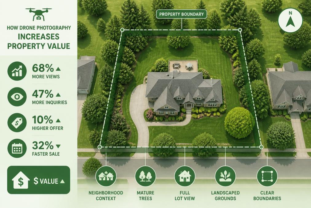
Professional aerial photography delivers tangible advantages that ground-level imagery cannot match. The bird's-eye view creates immediate visual impact, captures property scale in context, and showcases lifestyle appeal through neighborhood positioning and surrounding amenities.
Faster Time on Market and Perceived Value
Properties listed with aerial imagery typically spend fewer days on market compared to traditional photo-only listings. Buyers scrolling through listings encounter a complete spatial narrative within seconds, lot boundaries, landscaping scope, driveway configuration, and relationship to neighboring properties all become apparent from a single aerial shot.
Perceived value increases measurably when buyers understand the full scope of what they're purchasing. A 2-acre parcel might appear unremarkable in street-level photos, but aerial imagery reveals mature tree coverage, setback distances, and potential development areas that justify premium pricing. Real estate professionals report that listings featuring aerial photography receive more serious inquiries earlier in the marketing cycle, compressing the sales timeline and reducing carrying costs for sellers.
Enhanced First Impressions and Curb Appeal
Aerial views establish curb appeal at a neighborhood scale. Buyers see how the property integrates with its surroundings, whether it sits on a quiet cul-de-sac or busy thoroughfare, and what the immediate geographic context offers in terms of privacy, views, or commercial proximity.
High-end properties benefit particularly from this expanded visual storytelling. A $2M home with professional landscaping becomes infinitely more compelling when buyers see the manicured grounds, pool design, and outdoor living spaces from above. Seasonal timing amplifies first-impression impact, spring and summer aerial photography captures vibrant landscaping and optimal lighting conditions, while winter imagery emphasizes architectural features when foliage is sparse.
Real Estate Drone Photography Pricing and ROI Calculation
Understanding the investment required for professional aerial imagery and measuring its financial return helps sellers make confident decisions about listing strategy.
Understanding Pricing Models
Real estate drone photography pricing varies based on property size, location complexity, turnaround time, and post-production requirements. Most professional drone operators offer tiered packages: basic aerial photo packages for simple residential properties, comprehensive packages including video and multiple angles, and premium services with advanced editing or 3D integration.
Many operators offer package pricing rather than hourly rates, providing cost predictability for sellers and agents. Some drone service providers include basic editing, while others charge separately for color correction, object removal, or enhanced post-production.
Measuring Return on Investment for Sellers
ROI calculation for aerial photography begins with baseline metrics: average days on market for comparable properties in your area, median sale price for similar listings, and typical marketing investment per property.
The most direct ROI measurement tracks time on market reduction. If aerial photography reduces marketing duration by 7-10 days, that translates to immediate savings in carrying costs, property taxes, insurance, and utilities. For a $400,000 property with monthly carrying costs of $1,200, reducing time on market by one week saves approximately $280 in direct expenses.
Properties with professional aerial imagery often receive more competitive offers and higher final sale prices. Real estate professionals report that buyers perceive properties with comprehensive visual documentation as better-maintained and more transparent. This perception advantage can translate to 1-3% price premiums, which on a $400,000 property equals $4,000-$12,000 in additional revenue.
Calculate your specific ROI by documenting listing metrics: marketing duration, final sale price, number of showings, and offer quality. Compare these outcomes against comparable properties that didn't feature aerial photography.
FAA Part 107 Requirements for Real Estate Drone Operations
Flying commercial drones over property requires federal certification and compliance with strict regulations. The FAA Part 107 framework governs all commercial drone operations in the United States, including real estate photography and videography.
Part 107 Remote Pilot Certification is mandatory for any commercial drone operation. This certification requires passing a written knowledge test covering airspace regulations, weather considerations, emergency procedures, and operational limitations.
Key Part 107 operational restrictions include:
- Maximum altitude of 400 feet above ground level
- Visual line of sight requirement (pilot must maintain direct visual contact with aircraft)
- Daylight-only operations (30 minutes before sunrise through 30 minutes after sunset)
- No operations over people or moving vehicles
- Maximum ground speed of 100 miles per hour
- Minimum distance of 500 feet horizontally from non-participating people
Airspace authorization requirements vary by location. Operations near airports or within controlled airspace require explicit FAA approval through the LAANC (Low Altitude Authorization and Notification Capability) system or direct FAA coordination.
Insurance requirements are equally important. Professional liability and general liability coverage protect both the drone operator and property owner against accidents, property damage, or injury claims. Reputable drone service providers maintain current insurance documentation and can provide proof of coverage upon request.
When hiring a drone service provider like Airborne Assets LLC for your property, verify their Part 107 certification, current insurance coverage, and understanding of local airspace restrictions.
Technical Considerations and Post-Production Standards
Professional aerial photography requires technical expertise in both flight operations and image processing.
High-Resolution Imagery and Editing Standards
Professional-grade drone cameras capture images at resolutions supporting large-format printing and detailed digital inspection. High-resolution imagery (20+ megapixels) provides flexibility for cropping, zooming, and creating multiple compositions from single flights.
CALL Clear Focus Imaging TODAY →
Post-production editing includes color correction to ensure accurate representation of property features, white balance adjustment for consistent lighting, and exposure optimization to reveal detail in both bright and shadowed areas. Object removal can eliminate temporary objects, parked cars, or construction equipment without distorting the property's appearance.
Consistency across the image set matters significantly. All photos should share similar color grading, contrast levels, and brightness to create a cohesive visual narrative.
Integration with 3D Virtual Tours
Modern real estate marketing increasingly combines aerial photography with 3D virtual tour technology. 3D virtual tours typically begin with an aerial establishing shot, then transition to ground-level entry and interior navigation, providing buyers with complete spatial understanding.
Matterport and similar 3D tour platforms integrate aerial photography as opening scenes. Professional drone operators increasingly offer bundled services combining aerial photography with 3D tour creation, ensuring seamless visual transitions and consistent color grading throughout the experience.
Seasonal Strategies and Property-Type Applications
Timing drone photography to maximize visual impact requires understanding seasonal advantages and property-specific considerations.
Timing for Maximum Impact
Spring and summer offer optimal lighting conditions for aerial photography. Clear skies, vibrant landscaping, and longer daylight hours create compelling visual narratives. Spring imagery captures fresh vegetation and blooming landscaping, while summer photography emphasizes pool features and outdoor living spaces.
Fall photography captures dramatic foliage and clear air quality that reveals neighborhood context and distant views. Winter imagery can emphasize architectural features and property boundaries when trees are bare.
Market timing considerations affect when to deploy aerial photography. Properties listed in spring and summer face more competition, making professional aerial imagery more valuable for differentiation. Scheduling photography around optimal weather conditions ensures professional results.
Luxury Listings and Unique Property Angles
Luxury properties benefit disproportionately from professional aerial photography. High-end buyers expect comprehensive visual documentation and appreciate unique perspectives that showcase investment quality. Aerial imagery validates premium pricing by revealing property scale, landscaping investment, and exclusive positioning.
Drone photography for luxury listings often includes multiple angles and comprehensive coverage. Waterfront properties benefit from aerial photography showing shoreline access and water view scope. Properties with notable architectural features, pools, or distinctive rooflines warrant aerial angles emphasizing these premium elements.
Maximizing Social Media Engagement with Aerial Visuals
Aerial imagery drives social media engagement at rates exceeding traditional real estate photography. The unique perspective captures attention within the first 1-2 seconds of feed scrolling, translating directly into higher engagement rates and expanded organic reach.
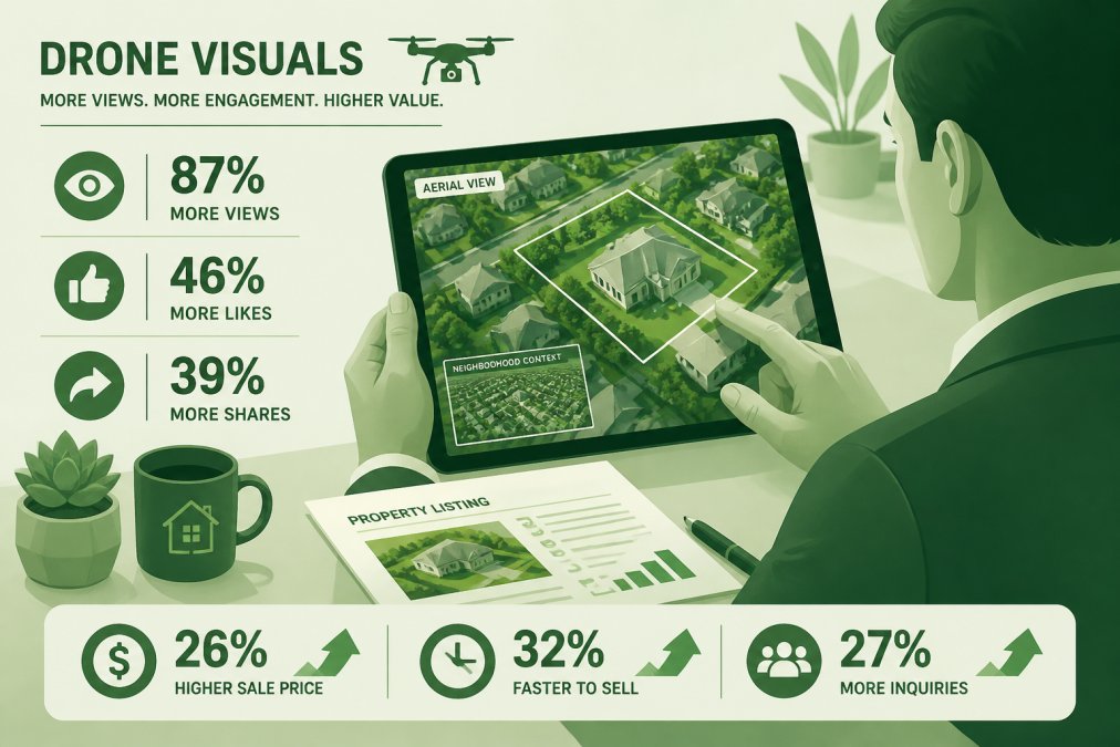
Platform-specific optimization maximizes performance. Instagram favors high-contrast, visually striking imagery; aerial photos of properties with distinctive features perform exceptionally well. Facebook's algorithm rewards video content; aerial video clips with motion and music generate higher engagement than static images. LinkedIn appeals to commercial property buyers; aerial imagery showcasing development potential drives professional engagement.
Video content substantially outperforms static imagery across all platforms. Aerial video clips showing property approach, perimeter navigation, and neighborhood context create narrative momentum. Short-form video (15-30 seconds) works well for social media feeds, while longer-form content (2-3 minutes) suits website embedding.
Hashtag strategy amplifies reach for aerial real estate content. Location-specific hashtags, property-type hashtags, and drone-specific hashtags connect your content with interested buyers and agents. Track engagement metrics to reveal which aerial angles and property types generate highest engagement, informing future photography strategy.
Conclusion
How drone photography increases property value through multiple mechanisms: faster market time, enhanced buyer perception, superior visual storytelling, and competitive differentiation. Properties marketed with professional aerial imagery consistently outperform comparable listings lacking these assets, generating measurable ROI through reduced carrying costs, higher sale prices, and improved offer quality.
The investment in professional aerial photography, when executed with technical expertise, regulatory compliance, and strategic timing, delivers returns that justify the expense for most property types. Real estate agents, developers, and individual sellers who use aerial imagery gain competitive advantage in crowded markets and command premium positioning in buyer consideration.
At Airborne Assets LLC, we specialize in transforming property listings through professional aerial photography and videography. Our FAA Part 107-certified pilots combine technical expertise with creative composition to capture your property's unique value proposition. Whether you're marketing residential properties, construction sites, agricultural land, or industrial facilities, professional aerial imagery elevates your listing and accelerates your sales timeline.
Contact Airborne Assets LLC today for a free consultation. Let our team demonstrate how professional drone photography can transform your property marketing strategy and maximize your investment returns.
Frequently Asked Questions
Does drone photography actually help sell homes faster?
Yes. Properties with aerial imagery typically spend less time on market because buyers gain a comprehensive understanding of property scale, surrounding grounds, and neighborhood context from the first listing view. This bird's-eye perspective creates stronger first impressions and increases listing engagement, leading to faster conversions. The visual storytelling capability of drone photography directly impacts buyer interest and perceived value.
What are the FAA regulations for real estate drone photography?
Real estate drone operators must comply with FAA Part 107 requirements, which mandate that pilots hold a Remote Pilot Certificate, keep the drone within visual line of sight, maintain altitude below 400 feet, and avoid flying over people or moving vehicles. Part 107 also restricts commercial operations during certain conditions. Hiring a certified FAA Part 107 pilot ensures your aerial photography is legally compliant and professionally executed.
How much does real estate drone photography cost, and will I see ROI?
Pricing for real estate drone photography depends on property size, location complexity, editing requirements, and package scope. Rather than a flat rate, most professional services offer customized quotes. ROI typically materializes through faster sales, higher perceived value, and increased listing visibility in competitive markets. Calculate your ROI by comparing the cost of drone services against the average price increase and time-on-market reduction for properties with aerial imagery versus those without.
What should be included in a professional real estate drone photography package?
A comprehensive package includes high-resolution aerial imagery showcasing property boundaries and surrounding grounds, professional post-production editing, multiple angles highlighting neighborhood amenities and lifestyle appeal, and integration-ready digital assets for listing platforms and social media. Many packages now include 3D virtual tour compatibility, allowing potential buyers to explore the property from multiple perspectives. Ensure the package meets your timeline for getting final footage to market quickly.
This article was written using GrandRanker
