Best Drone Services in Gaffney: A 2026 Guide
Table of Contents
- Why Drone Services Matter for Your Business
- Clear Focus Imaging: Professional Aerial Photography and Videography
- CGA Solutions: FAA-Approved Drone Services Across South Carolina
- SC Aerial Solutions: Construction Monitoring and Precision Mapping
- Spot Drone Imaging Services: Specialized Industrial and Agricultural Inspections
- Average Cost of Drone Photography: What to Budget
- FAA Part 107 Drone Regulations: Compliance and Certification
- How to Choose the Right Drone Service Provider
Last Updated: August 18, 2026
Why Drone Services Matter for Your Business
Aerial imagery has become essential for businesses across multiple industries. What once required expensive helicopter rentals now happens with precision drone technology. Real estate agents close listings faster with aerial property views. Construction managers track progress accurately without climbing ladders. Agricultural operators monitor crop health across hundreds of acres in minutes. The shift toward drone services is a practical tool that delivers measurable results.
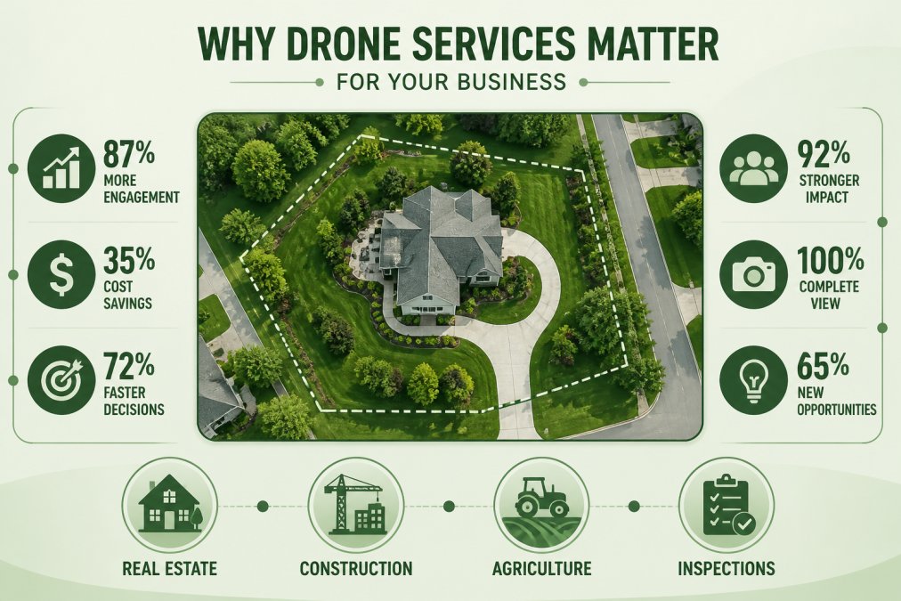
Drone services in Gaffney have grown substantially as businesses recognize their value. The technology captures perspectives impossible from ground level. For real estate, aerial shots increase listing engagement and reduce time on market. For construction, aerial documentation creates accountability and prevents costly miscommunications. For agriculture, thermal and multispectral imaging reveals crop stress before it becomes a financial loss.
A drone pilot with FAA Part 107 certification brings professional standards and legal compliance to every flight. They understand airspace regulations, weather conditions, and safety protocols that protect your property and liability.
Clear Focus Imaging: Professional Aerial Photography and Videography
Clear Focus Imaging operates as a local provider specializing in the applications most businesses in this region need. Their service model centers on custom solutions rather than one-size-fits-all packages. Real estate agents get high-definition aerial photography tailored to property type and listing goals. Construction teams receive progress documentation with the precision needed for project management and stakeholder reporting.
The company's focus spans real estate, construction, agriculture, and inspections, four sectors where drone services directly impact revenue or operational efficiency. For real estate, aerial videography and photography showcase properties from angles that traditional photography cannot match. For construction, they provide documented progress that protects timelines and budgets. For agriculture, they offer aerial assessment capabilities that identify problems before they spread.
What separates Clear Focus Imaging from generic drone operators is their understanding of what each industry actually needs. Real estate agents don't just want pretty pictures; they want images that sell properties faster and at better prices. Construction managers want documented proof of progress and compliance. This specificity means the service is a business tool, not just aerial photography.
Clear Focus Imaging offers a free consultation to discuss your specific needs before any commitment. This approach lets you understand exactly what drone services can deliver for your situation.
Average Cost of Drone Photography: What to Budget
Understanding drone service costs requires recognizing that pricing varies based on multiple factors. There's no single "standard" drone photography price because the work itself varies significantly.
Real estate drone photography typically falls into two categories: basic aerial photos or comprehensive video packages. Basic aerial photography for a single property costs less than full videography with editing and color grading.
Construction progress documentation pricing depends on project size and frequency. A single aerial survey costs less than ongoing monthly documentation. However, many construction managers find that monthly aerial documentation prevents costly miscommunications about progress and site conditions.
Agricultural drone services pricing depends on acreage and the type of analysis required. A simple aerial survey of crop health costs less than detailed multispectral analysis with recommendations.
Inspection services for industrial facilities pricing depends on complexity and accessibility. A straightforward roof inspection costs less than a comprehensive facility assessment involving thermal imaging and detailed reporting.
The pattern across all applications is consistent: basic aerial photography costs less than comprehensive analysis and reporting. Most professional drone service providers in this region offer quote-based pricing. A free consultation lets you understand what a specific project will cost before committing.
FAA Part 107 Drone Regulations: Compliance and Certification
Flying a drone commercially requires FAA Part 107 certification. This is not optional, it's a federal requirement. Understanding what this means protects you legally and ensures the operator you hire meets professional standards.
FAA Part 107 certification means the pilot has passed an examination covering airspace regulations, safety protocols, and operational limitations. The certification requires understanding where drones can and cannot fly, how weather affects operations, and how to maintain safe distances from people and property.
The regulations prohibit flying beyond visual line of sight, flying at night without special waivers, and flying over people or moving vehicles without specific authorization. These limitations exist for safety reasons. A pilot with Part 107 certification understands these limitations and operates within them.
When hiring a drone service provider, verify their FAA Part 107 certification. Operating without certification exposes you to legal liability if anything goes wrong. It also means the operator hasn't demonstrated the knowledge required to operate safely.
CALL Clear Focus Imaging TODAY →
Local regulations in Gaffney may add additional restrictions beyond federal requirements. Some municipalities require permits for drone operations. A professional operator will know these local requirements and handle any necessary permits.
How to Choose the Right Drone Service Provider
Selecting a drone service provider requires evaluating multiple factors beyond just price. The cheapest option isn't always the best value.
Start by clearly defining what you need. Are you looking for real estate listing photos? Construction progress documentation? Agricultural crop assessment? Industrial inspection? The specific application determines what capabilities matter most.
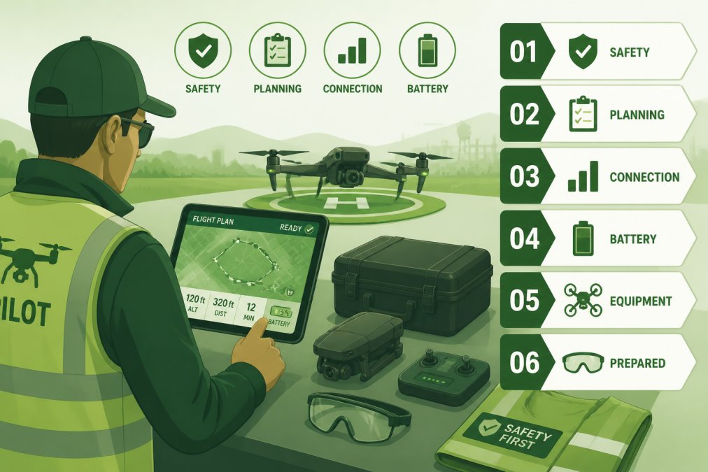
Verify FAA Part 107 certification and insurance. Ask to see documentation. This is non-negotiable.
Request examples of previous work in your specific industry. Real estate agents should see real estate projects. Construction companies should see construction documentation. Agricultural operations should see crop assessment work. The portfolio demonstrates whether the provider understands your industry's specific needs.
Discuss turnaround time for deliverables. How long between the flight and receiving final images or video? If you need imagery quickly for listings or project documentation, turnaround time matters significantly.
Ask about the post-production process. Raw drone footage often requires color grading, editing, and formatting before it's ready to use. Does the provider include editing in their quoted price? Professional providers typically handle all post-production work.
Understand what's included in the quoted price. Does it cover just the flight and basic images? Does it include edited video? Does it include detailed reporting or analysis? Clear pricing prevents surprises later.
Discuss revisions and guarantees. What happens if weather forces a rescheduled flight? What if you're not satisfied with initial results? Professional providers typically offer revision flights without additional cost if issues arise during their execution.
Consider local knowledge. A provider familiar with Gaffney's geography, weather patterns, and local airspace restrictions has an advantage over operators unfamiliar with the area.
Clear Focus Imaging combines local presence with the specific industry expertise most businesses in this region need. Their free consultation process lets you evaluate whether they're the right fit for your project before any commitment. They understand real estate, construction, agriculture, and inspection applications, the core industries where drone services deliver measurable value in this region.
Choosing the right drone service provider directly impacts whether you get results that improve your business. The decision isn't just about getting aerial photos; it's about partnering with someone who understands your industry and delivers work that serves your business goals. Clear Focus Imaging offers professional aerial photography and videography with the industry expertise and local knowledge that makes the difference. Get started with a free consultation to discuss your specific needs and see how professional drone services can transform your projects.
Frequently Asked Questions
How much does professional drone photography cost in South Carolina?
Pricing for drone services varies based on project scope, location, and deliverables. Real estate drone packages start around $70-$125 for basic aerial photos, while comprehensive services with video, virtual tours, and editing can range higher. Construction monitoring, thermal imaging, and inspection services typically require custom quotes. Contact providers directly for current pricing tailored to your specific needs, as costs depend on flight time, post-production requirements, and service complexity.
Are drone pilots required to have FAA Part 107 certification?
Yes, any commercial drone operation requires FAA Part 107 certification from the remote pilot in command. This federal requirement ensures operators understand airspace rules, safety protocols, and flight restrictions. When hiring drone services, verify that your provider employs FAA Part 107 certified pilots and maintains proper insurance. Certification demonstrates compliance with federal regulations and protects your project from legal liability.
What industries benefit most from drone inspection services?
Construction, agriculture, industrial facilities, and real estate are the primary beneficiaries. Construction companies use drones for progress monitoring and site documentation. Agricultural operations leverage thermal imaging for crop health assessment. Industrial clients rely on drones for roof inspections, tower assessments, and infrastructure monitoring. Real estate professionals use aerial videography to showcase properties. Each industry gains specific advantages: cost savings, faster documentation, safer inspections, and enhanced marketing materials.
How can aerial drone footage improve real estate listings?
Aerial drone footage provides unique perspectives that ground-level photography cannot capture, showing property size, lot layout, landscaping, and neighborhood context. High-definition 4K videography creates engaging listing content that attracts more qualified buyers and can reduce time on market. Virtual tours and flyover videos help buyers understand property boundaries and surroundings before visiting. Professional aerial visuals increase perceived property value and give agents a competitive advantage when marketing homes.
This article was written using GrandRanker
