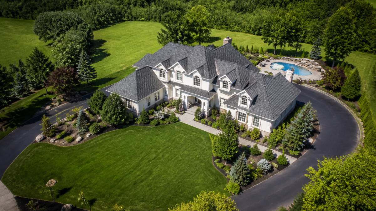
Benefits of Aerial Real Estate Photography
Table of Contents
- Why Aerial Real Estate Photography Changes How Buyers See a Listing
- How Drone Photography Shows Property Scale, Boundaries, and Layout
- Highlighting Land, Outdoor Features, and Topography From Above
- Real Estate Aerial Photography Examples That Sell Listings
- Best Practices for Real Estate Drone Photography
- Real Estate Drone Photography Cost and Return on Investment
- When Aerial Photography Is Not Worth It for a Listing
- Conclusion: Matching Aerial Coverage to the Property
- Frequently Asked Questions
Last Updated: October 4, 2026
Why Aerial Real Estate Photography Changes How Buyers See a Listing
Aerial real estate photography uses drone-mounted cameras to capture elevated, high-resolution images of a property, its buildings, and surrounding land.
The core benefit: an elevated view shows buyers what no ground shot can.
Most sellers and agents know aerial images look impressive, but miss that they do real work in the sales process.
Below, we break down the benefits of aerial real estate photography and when it is worth the spend.
The Ground-Level Problem Aerial Photos Solve
Ground-level photography has a blind spot buyers care about most: a standard camera captures a kitchen, bedroom, and facade, but cannot show acreage, lot lines, or how a property relates to the land around it.
That gap matters in rural and semi-rural markets, where land is often the main selling point.
Aerial images also cut down on surprise: when buyers cannot see boundaries or surroundings, they arrive with wrong assumptions. Clear aerial views set accurate expectations before the visit.
How Drone Photography Shows Property Scale, Boundaries, and Layout
Drone photography shows scale, boundaries, and layout by capturing the entire parcel in one elevated frame, house, outbuildings, driveway, and fence lines, all in correct proportion.
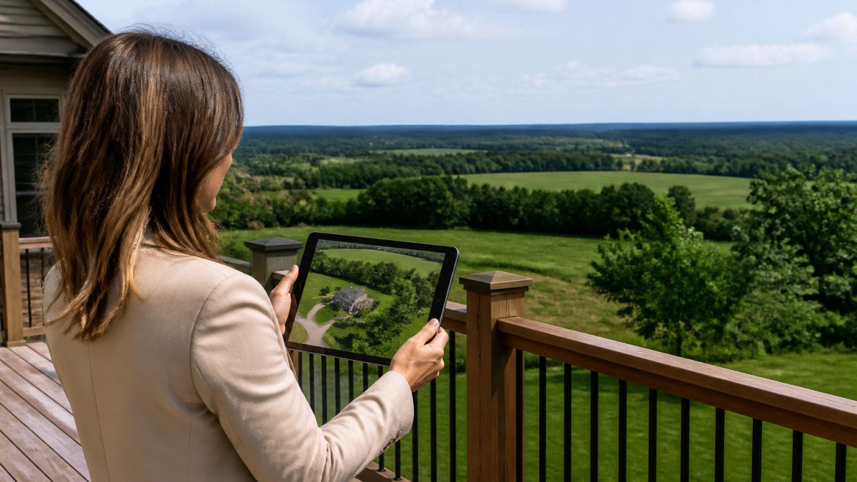
That single frame communicates size instantly. Buyers understand it faster from above than from reading "2.4 acres" in a listing description: words describe scale, aerial images demonstrate it.
Most listings fall short here: agents list dimensions and acreage, then show only ground-level shots, leaving the buyer to imagine the rest. Aerial coverage removes the guesswork.
Communicating Acreage and Lot Lines in One Frame
Acreage is hard to sell with words, "ten acres" means little to a buyer who cannot picture it. An overhead image with visible fence lines and tree borders makes the number concrete.
For land-heavy listings, one aerial frame shows the buildable area, wooded section, creek, and road frontage at once. Buyers seeking land for farming, hunting, or development judge fit in seconds, the difference between a saved listing and a skipped one.
Highlighting Land, Outdoor Features, and Topography From Above
Aerial views reveal outdoor features and terrain that ground photography flattens or hides: ponds, pastures, trails, orchards, outbuildings, and the shape of the land itself.
Topography is the quiet factor in many rural sales. A well-draining slope, a flat pad ready for a barn, or a ridge with a view are selling points invisible from the ground, and from the air, the reason a buyer calls.
This is where aerial coverage earns its keep on recreational and agricultural properties.
Real Estate Aerial Photography Examples That Sell Listings
Strong aerial sets tell a story from wide to close, pairing context shots with detail shots so buyers understand both the property and its surroundings.
Here is what separates a set that sells from a set that just looks nice:
- A wide establishing shot showing the full parcel and its boundaries
- A mid-range overhead highlighting the home, outbuildings, and driveway layout
- Detail shots of key outdoor features like a pond, pool, or pasture
What a Strong Aerial Set Actually Includes
A complete aerial set covers the property from multiple heights and angles, not one straight-down shot. The goal is coverage: buyers should finish the set knowing the layout, land, and location.
| Shot Type | What It Shows | Why It Matters |
|---|---|---|
| Wide establishing shot | Full parcel, boundaries, tree lines | Communicates scale at a glance |
| Mid-range overhead | Home, outbuildings, driveway | Shows layout and access |
| Feature detail shot | Pond, pool, pasture, trails | Highlights outdoor selling points |
| Context shot | Roads, neighboring land, amenities | Answers location questions |
Best Practices for Real Estate Drone Photography
Good aerial photography starts with planning, not flying: shoot at the right time of day, choose angles that flatter the property, and capture enough coverage for a complete picture.
A few practices consistently separate professional results from casual drone shots:
CALL Clear Focus Imaging TODAY →
- Shoot in soft morning or late-afternoon light to avoid harsh shadows
- Capture the property from multiple heights, not just straight down
- Include the surrounding area so buyers understand location context
Federal rules also apply. Commercial drone flights in the United States require a certified remote pilot operating under FAA Part 107 rules, which covers registration, airspace, and safety requirements. Hiring a certified operator keeps a listing compliant and protects the agent from liability.
Real Estate Drone Photography Cost and Return on Investment
The practical question agents ask is whether the shoot pays for itself. That comes down to two things: what drives the price, and how to measure return against listing performance.
What Drives the Price of a Drone Shoot
Aerial pricing is scoped per property, not sold off a flat menu, because the work scales with the job. The biggest factors:
- Property size and complexity, a quarter-acre suburban lot needs one flight plan; 40 acres of timber and pasture needs several, plus more battery swaps and more frames to sort.
- Deliverables, stills only is the base. Adding drone video, a vertical social cut, or a 3D tour raises the scope and the price.
- Editing and turnaround, standard color correction and horizon leveling are usually included; rush delivery, sky replacement, or advanced retouching are add-ons.
A common market pattern is tiered: a base stills package for standard residential listings, a mid-tier package adding video, and a custom quote for acreage, commercial, or inspection work. Ask providers to itemize inclusions so you can compare quotes apples to apples.
How to Judge Return on Investment
ROI on aerial coverage compares shoot cost against the listing outcomes it supports. Three practical ways to frame it:
- Cost per listing day saved. If aerial coverage helps a listing go under contract even a few days sooner, compare the shoot cost against the carrying cost of those days (mortgage, taxes, insurance, utilities). On higher-priced homes, that math often favors the shoot.
- Cost per qualified showing. Aerial images tend to filter out buyers who assumed the lot was smaller or the surroundings different. Fewer wasted showings means less agent time spent on unqualified traffic.
- Cost as a share of marketing spend. Compare the aerial quote against what the listing already spends on professional stills, staging, print, and paid promotion. Aerial coverage is usually a small slice of that total, and it is the slice that shows what ground photos cannot.
A useful rule of thumb: if land, acreage, a view, or location context is a selling point, the aerial shoot is doing real marketing work and the ROI case is straightforward. If none of those apply, the spend is better redirected to interiors or staging.
A Note on Pricing Transparency
Because scope varies so much, the honest answer to 'how much does it cost' is: it depends on the property and deliverables. A good provider walks the property, confirms the shot list, and quotes accordingly, and will say when a smaller package is right. A flat rate quoted without asking about the property signals they are not scoping the work.
When Aerial Photography Is Not Worth It for a Listing
Aerial coverage is a tool, not a default. Decide with one question: does the elevated view show a buyer something the ground cannot? If not, the spend belongs elsewhere.
Skip Aerial Coverage When the Ground Shot Already Tells the Story
- Small, flat suburban lots where the entire yard, fence line, and roofline are visible from the street or a standard wide-angle shot.
- Condos, townhomes, and units with no private land, no distinct roofline, and no exterior feature that reads from above.
- Dense urban infill where the surrounding context is other buildings and the lot is a postage stamp.
In these cases, the same budget usually produces a bigger lift when redirected to professional interior stills, twilight exterior shots, staging, or a floor plan.
The Decision Framework: Four Questions
Run every listing through these before booking a flight:
- Is there land or acreage? If the lot is a meaningful part of the value, aerial coverage earns its place.
- Is there a view, water feature, or topography worth showing? Ridges, ponds, creeks, and slopes are invisible from the ground.
- Does location context matter to the buyer? Proximity to trails, schools, amenities, or open space is easier to show from above.
- Is the property distinctive enough to benefit from a hero image? Aerial 'hero' shots help listings stand out in search results, but only if the property has something worth framing.
Two or more 'yes' answers generally justify the shoot. Zero or one usually does not.
The Trade-Off in Plain Terms
Every marketing dollar is finite. If a listing has a weak interior and strong land, fix the interior first and add aerial coverage second. If the interior is strong and the land is the differentiator, aerial coverage is the higher-leverage spend. The benefit of aerial real estate photography comes from showing what the ground cannot, when there is nothing extra to show, the same money does more work elsewhere.
If the property has land, a view, acreage, or a location that matters, aerial coverage earns its place and typically pays for itself in qualified attention.
Conclusion: Matching Aerial Coverage to the Property
The benefits of aerial real estate photography come down to fit. When a property has land, acreage, outdoor features, or a location worth showing, aerial images communicate what ground photos cannot, helping listings stand out and sell faster.
That is where Clear Focus Imaging comes in. We provide professional Real Estate Media with custom solutions built around each property, plus specialized coverage for construction and inspections.
Get started with Clear Focus Imaging and give your next listing the elevated view that helps it sell.
Frequently Asked Questions
Why is aerial real estate photography worth it for a listing?
Aerial real estate photography answers questions buyers ask before they ever schedule a showing: how big is the lot, where are the property lines, what sits next door, and how does the home relate to the land around it. Ground-level shots cannot show acreage, topography, or neighborhood context in one frame. Drone images also give listings a visual edge in crowded search results, which supports stronger click-through and more qualified showing requests.
What should real estate drone photos show?
A complete set covers the property from several angles and heights: a straight-down view that maps the lot and boundaries, an angled elevated view of the home and surrounding grounds, close shots of outdoor features like pools, barns, or outbuildings, and wider frames that place the property in its neighborhood. Include nearby amenities such as parks, schools, or waterfront access when they add value. Ground-level shots should still anchor the set so buyers see interior and entry details.
Is drone photography legal for real estate listings?
Yes, when the pilot follows FAA rules under Part 107, which covers commercial drone operations in the United States. That includes keeping the aircraft within visual line of sight, avoiding restricted airspace without authorization, and not flying over people who are not part of the operation. Ask any photographer for their Part 107 certificate before booking. A certified pilot handles airspace checks and permissions, which protects the agent and the seller.
How much does real estate drone photography cost, and how fast is the ROI?
Pricing depends on the size of the property, the number of finished images, travel distance, and whether video or 3D tours are included, so ask for a quote based on your listing. The return shows up through stronger listing engagement and fewer wasted showings, since buyers can rule a property in or out from the aerial set.
